
USA-wide parcel coverage | automated data quality checks | change intelligence
Next-Gen Parcel Intelligence Platform.
ParcelMetric (ParcelMetric.com) consolidates nationwide parcel data, ownership history, and GIS-ready outputs into a single system. Start by integrating with your existing GIS, or make ParcelMetric the primary platform for data quality, governance, and change detection.
States + DC
County assessor feeds
Change monitoring
App + web views
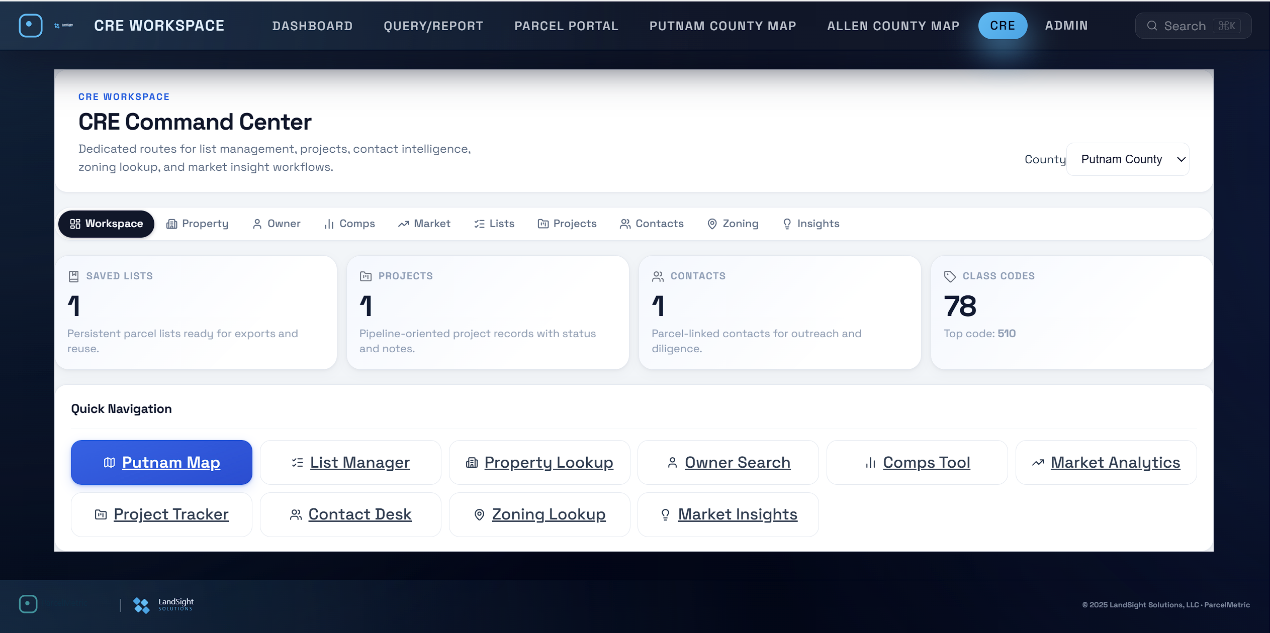
See ParcelMetric across web and mobile views.
The platform looks and feels modern across desktop and mobile. Give teams a map-first interface for parcel search, ownership history, data quality checks, and change intelligence.
Mobile-ready parcel workflows
Surface parcel changes, data quality signals, and ownership context in a clean interface built for field and leadership teams.
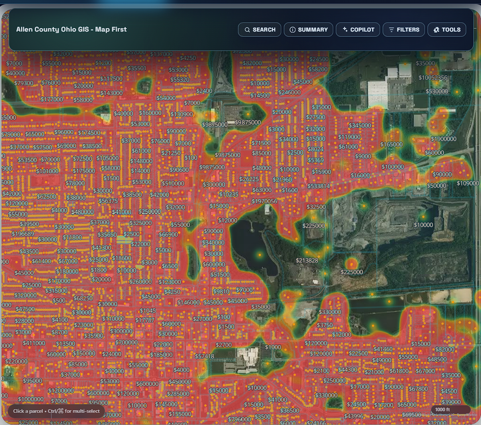
Explore the platform →CRE sales workspace
Show buyers and brokers a map-first story they trust.
Present parcel intelligence with real map context: comps, ownership, zoning, and market trend visuals in one polished workflow built for CRE sales conversations.
Everything in one CRE command center.
Move from a static PDF to an interactive sales narrative. Use map layers and market heatmaps to explain pricing, identify targets, and back up valuation assumptions in seconds.
Parcels in active market read
From subject parcel to comps run
Heatmap, zoning, and value overlays
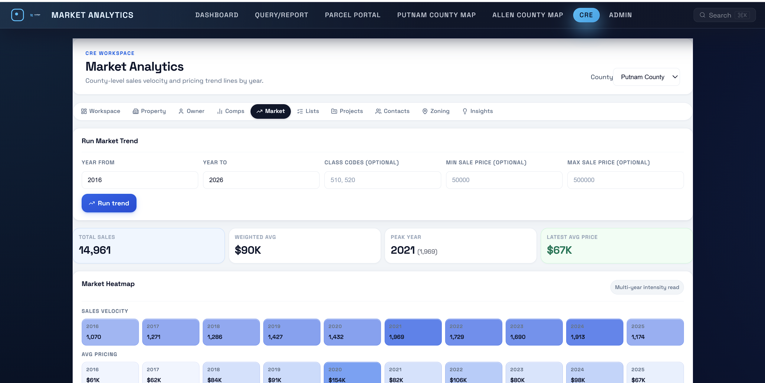
 Property intelligence
 Comps toolMarket analytics
 Market insights
 Sales cluster: 2020 +70.6%Avg price trend: $61K to $154K
How ParcelMetric works
A modern parcel intelligence pipeline from intake to delivery.
You don't need more data files. You need an operating system for parcels: intake, data quality checks, change detection, governance, and delivery.
Ingest and normalize assessor feeds
Bring messy county formats into a consistent, GIS-ready parcel schema across a region, state, or nationwide program.
- Automated intake from assessor updates
- Normalization to a consistent schema
- History preserved for audits


ParcelMetric platform
One parcel operating system for auditors, GIS, recorders, and leaders.
ParcelMetric brings parcel search, ownership, sales comps, risk scores, tax intelligence, and reporting into one elegant workspace. Copilot and smart search answer complex questions in seconds while workflows stay audit-ready.
Replace fragmented parcel tools
Instant answers across every parcel
Surface revenue and compliance gaps
Auto-generated market evidence

Usage
Parcel data workflows teams run every day.
Replace spreadsheets and one-off scripts with a modern, image-first workflow built for GIS teams and land data operations.
Parcel data quality + review
Run automated checks, review exceptions, and keep parcel records audit-ready.
Explore data quality workflowsOwnership change intelligence
Track boundary, ownership, and attribute updates with explainable summaries.
See change use casesBuilt for scale
From one county to 50 states without sacrificing accuracy.
ParcelMetric is engineered for USA-wide programs with governance and data quality at the core. Whether you're a county GIS office, a statewide program lead, a utility, or a national portfolio team, the platform is designed to scale.
Core outcomes
Move from reactive parcel maintenance to proactive parcel intelligence.
- Less manual quality checks and rework
- Reliable parcel lineage for compliance
- Change intelligence leaders can act on
Replacement + integration
Integrate with GIS, or replace it where it matters.
ParcelMetric is designed to fit reality: some teams keep ArcGIS for map authoring while replacing parcel maintenance and quality checks. Others standardize on ParcelMetric as the primary system for parcel workflows.
Integration-first
Start with exports/APIs, then expand into governance and change intelligence.
Replacement-first
Replace manual parcel workflows immediately: quality checks, lineage, change review, and delivery.
Hybrid
Keep what you love, replace what's slowing you down, and modernize in weeks.
Frequently asked
Answers for parcel and GIS teams.
Do you cover every state in the United States?
Yes. ParcelMetric is designed for USA-wide coverage across all 50 states plus DC.
Can ParcelMetric replace legacy GIS parcel workflows?
Yes. ParcelMetric can integrate with existing GIS, and it can also become the primary system for parcel data quality, governance, and change intelligence, replacing manual and legacy parcel maintenance when desired.
How fast can you deploy?
Most programs move from discovery to live outputs in weeks depending on scope and data complexity.
Ready to replace legacy parcel workflows?
Book a ParcelMetric demo.
We'll tailor the demo to your team: county, state, utilities, telecom, or enterprise portfolios.